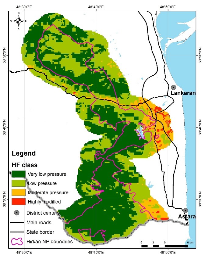
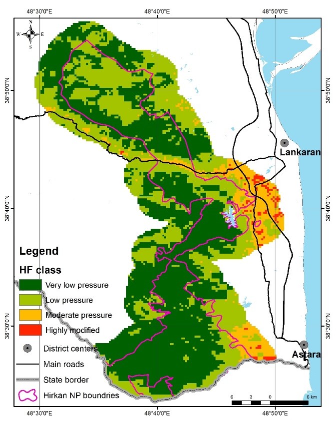
Hirkan National Park is one of the most important protected areas of Azerbaijan, conserving valuable forest ecosystems with high biodiversity, relict vegetation, and significant conservation value. This study evaluates the spatial and temporal characteristics of anthropogenic influence in Hirkan National Park and its buffer zone using the annual terrestrial Human Footprint dataset. Multi-year raster data covering approximately two decades were processed in a GIS environment and classified into four categories of anthropogenic influence: very low, low, moderate, and highly modified areas. The results indicate that the study area is generally dominated by landscapes with limited anthropogenic transformation, while more modified zones occur mainly in accessible areas. Moderate and highly modified landscapes are concentrated near main road networks, and settlements. Although the overall landscape structure re-mains relatively stable, the analysis reveals a gradual reduction of the least affected areas and a slight expansion of highly modified zones. These changes indicate the need for continued monitoring, especial-ly in buffer-zone and road-adjacent landscapes. The applied approach provides a spatially explicit basis for identifying vulnerable zones where anthropogenic transformation is more pronounced. These results can contribute to more targeted environmental monitoring, improved buffer-zone regulation, and the development of site-specific management strategies for Hirkan National Park.